


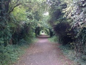
‘Sustrans’ Cycle Path on MSWJ
The Marlborough Branch Line from the terminus at Marlborough High Level Station to Savernake Low Level Station still exists ‘on-the-ground’, but lies on private property with no footpaths along its course. The Line itself is also heavily overgrown and not easily traversed.
There is a similar problem with the M&SWJ Line from Marlborough Low Level Station to Savernake High Level.
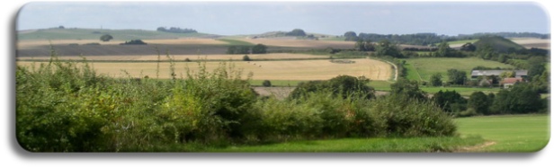
However, there are enough Rights of Way along their routes to enable a reasonable Walk of both railways, covering some of The Wansdyke along the route.
|
Distance: |
10 miles |
Walk Time: |
3 Hrs |
Total Time: |
4 Hrs |
|
No of Climbs |
1 |
Terrain: |
Climb of 140 ft |
Difficulty: |
Moderate 3 |
|
Price Band: |
C |
Features: |
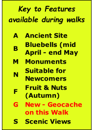
F N |
Spring Days: |
Any Day |
|
Distance: |
12 miles |
Walk Time: |
4 Hrs |
Total Time: |
5 Hrs |
|
No of Climbs |
2 |
Terrain: |
Climb of 140 ft |
Difficulty: |
Moderate 3.5 |
|
Price Band: |
D |
Features: |
F N |
Spring Days: |
Any Day |
|
Distance: |
8 miles |
Walk Time: |
3 Hrs |
Total Time: |
4 Hrs |
|
No of Climbs |
0 |
Terrain: |
Flat |
Difficulty: |
Easy 1 |
|
Price Band: |
C or D |
Features: |
F N G |
Spring Days: |
Any Day |

| Avebury |
| Kennet Valley |
| Martinsell |
| Marlborough |
| Savernake |
| Villages |
| West Woods |
| Custom Walks |
| Self-Guided Walks |
| Map & Compass |
| Ley Line Dowsing |
| Ancient Trees |
| Walking for Beginners |
| Beginners Backpacking |
| Geocaching |
| Corporate |
| Activities |
| Corporate |